Nashville & Middle Tennessee Greenways
Nashville & Middle Tennessee Greenways
Nashville & Middle Tennessee Greenways are being developed all around us in each community as our governments realize how much the outdoors means to great communities. Nashville has over 190 miles of trails in Davidson County that connect neighborhoods all over our community. The greenways offer free access to enjoy scenic landscaping like rivers and streams that wind in and out of communities all over the city. Don't miss Tennessee State Parks and our Middle Tennessee Parks either! Enjoy Life, Nashville Life!
Nashville Greenways
|
Owl's Hill Nature Sanctuary is a protected green space in northwestern Williamson County, Tennessee. Usage is dedicated to a mission of education, conservation, restoration, research, and species protection. Business Website:
Owl's Hill Nature Sanctuary
545 Beech Creek Road
37027
Brentwood
, TN
Phone:
615-370-4672
See map: Google Maps |
|
Two Rivers Park is a place where folks go to enjoy their time off in an idealistic "Neighborhood Park" Located in Donelson right next to the McGavock high school as well as right down the street from the Historic Two Rivers Mansion . Business Website:
Two Rivers Park
2235 2 Rivers Pkwy
37214
Nashville
, TN
See map: Google Maps |
|
Business Website: |
|
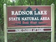
Radnor Lake is a 1,200-acre natural area located in Davidson County in the Overton Hills approximately eight miles south of downtown Nashville. Business Website:
Radnor Lake State Natural Area
1160 Otter Creek Road
37220
Nashville
, TN
Phone:
(615) 373-3467
See map: Google Maps |
|
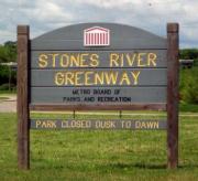
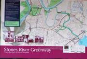
Stones River Greenway at Percy Priest Dam Trailhead – From I-40 east from Nashville take Stewarts Ferry Pike exit # 219. Turn right on Stewarts Ferry Pike and travel approximately ½ mile to Bell Road.
Nashville Greenway Trail - Stones River Greenway at Percy Priest Dam Trailhead
3734 Bell Road
37214
Nashville
, TN
See map: Google Maps |
|
Here is a good trailhead for folks who want to drive their cars with bikes to go. Easy acess from your car to the trailhead. This is a very quiet walk along the stones river however you do need to heed the bikes... Business Website:
Nashville Greenway Trail - Stones River Greenway at Kohl’s Trailhead
3001 Lebanon Rd
37214
Nashville
, TN
See map: Google Maps |
|
Stones River Greenway at Heartland Park Trailhead – From I-40 east, take exit #215B, at Briley Parkway north toward Opryland. Take the US-70 exit toward Lebanon Pike, exit #8. Turn left on McGavock Pike, turn right onto Fernbrook Lane.
Nashville Greenway Trail - Stones River Greenway at Heartland Park Trailhead
3135 Heartland Drive
37214
Nashville
, TN
See map: Google Maps |
|
Shelby Bottoms Greenway at Cooper Creek Trailhead – The Cooper Creek trailhead is located at McGinnis and Moss Rose Drive in the Inglewood neighborhood. Parking there is on-street only.
Nashville Greenway Trail - Shelby Bottoms Greenway at Cooper Creek Trailhead
2544 McGinnis Drive
37216
Nashville
, TN
See map: Google Maps |
|
Seven Mile Creek Greenway - 5301 Edmondson Pike, 37211. I-65 south to Exit 78A, Harding Place, East. Drive aprox. 2 miles to Overcrest Drive, turn right for .2 miles to Blackman Road and drive .2 to first right, Edmondson Pike, turn right. Business Website:
Nashville Greenway Trail - Seven Mile Creek Greenway
5301 Edmondson Pike
37205
Nashville
, TN
See map: Google Maps |
|
Richland Creek Greenway at McCabe Trailhead – 4601 Murphy Road. From I-40 west toward Memphis, merge onto I-440 east toward Knoxville. Take the Murphy Road exit # 1 toward West End Avenue, turn right onto Murphy Road. Business Website:
Nashville Greenway Trail - Richland Creek Greenway
26 White Bridge Road
37205
Nashville
, TN
See map: Google Maps |

